Access points
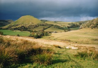
This is Chrome Hill about a mile to the west of Earl Sterndale . Parkhouse Hill is on the right side of the image. They are both now access land though I haven't been up Parkhouse yet.
There's no doubt that the creation of access land has given us a lot more places to walk but what we really need to know is where all the access points are.
The Peak Park have said they will soon have these details on their website but what we really want is the infomation on the OS Maps.
To be honest I've not used that much access land so far though I'm sure I'll use more in future - once I've finished my latest book !
No comments:
Post a Comment