Thursday, December 29, 2005

Festival of Winter Walks

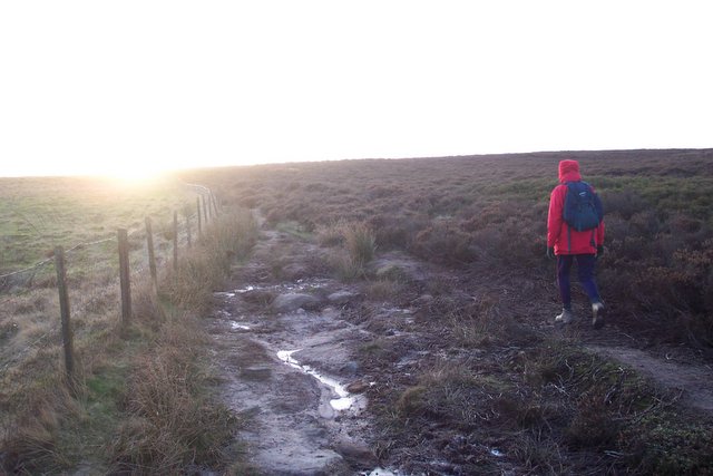
If you fancy a walk this Saturday, the 31st December, why not join me at Sir William Hill for a five to six mile morning walk in the vicinity of Eyam Moor. We're meeting at 10.00am and if you want to know exactly where then get in touch with me. I check this site morning and evening.

The walk I'm leading is part of the Ramblers' Festival of Winter Walks and there's a special offer available - you get 20% off membership of the Ramblers' Association if you join having been on the walk. That means that an individual subscription of £24 is reduced to £19.20 and joint membership from £32 to £25.60.

Gratton Dale

Gratton Dale near Elton is apparently a mess !

A recent letter I have seen speaks of a walker using the dale and being "horrified at the state of the path" with the damage caused being "immense".

If you're thinking of using the dale then be prepared. If you do use it then I would be interested in what you find.

Wednesday, December 28, 2005

Backdale Quarry and Longstone Edge

If you know the Peak District then you'll know there are strange happenings on Longstone Edge - you might say that's been the case for many years and you may be right.

Nowadays though the Edge is taking an even bigger pounding than it used to do - especially at Backdale Quarry. As you drive along the road between Hassop and Calver crossroads you may get a hint of this quarry to the west of the road but if you're walking to the east of the road along the Bramley Plantation ridge on Hassop Footpath No. 9 [yes each footpath can be identified by its parish and number] then you will get a view of the quarry face in all its 'glory'.

It is alleged that the quarry owner is overstepping the mark in that they are in breach of the planning permission. The Peak Park has taken enforcement action to stop the continued work but the quarry owner has appealed and a public inquiry will ensue - in the meantime more Peak District stone is ripped out of the hillside.

The website of the Save Longstone Edge campaign at http://www.longstone-edge.org.uk/ explains it much better than me - and they need your support - and they have the photographs - so why not have a look and see if there's anything you can do. By the way do watch the new dvd referred to on the homepage - it's well worth it.

Monday, December 26, 2005

4 x 4 fun - for how long ?


Here's a photo I took about a year ago between Earl Sterndale and Chelmorton - a little bit further along the track is the end of the High Peak Trail.

Since this photo was taken this track has been resurfaced with gravel and probably won't be so popular with trail riders or green laners.

There is a fierce debate between walkers on the one hand and green laners and trail riders on the other - who is right ? I don't know the answer ........

But what I can say is that one of the things that walkers object to [from their point of view] is that these green lanes/unclassified county roads are often made impassable to the person on foot - surely that isn't right is it ?

Wednesday, December 21, 2005

Peak Park's Paul

Paul Hopkins left the Peak Park yesterday. After the best part of 15 years he's left his job as Rights of Way Officer and is now exploring new ways of making a living.

He has done a great job in the time he has been there working to improve and safeguard the paths in the Peak District and we shall miss him. The trouble is that most walkers don't realise the amount of work that goes on just to maintain paths let alone improve them. A flight of wooden steps can take three or four workers three or four days to build - like the ones in Litton Frith, Cressbrookdale [these probably took longer in fact]. A stile can take the best part of a day for a couple of people to replace.

Let's hope he is adequately replaced. With talk of cutbacks though I wonder.

Sunday, December 18, 2005

Eyam Moor

It was very, very cold yesterday when we walked from Sir William Hill down to Stoke Ford. We then swung round towards Leam having walked a very muddy path through a plantation which had not so many years ago been an open hillside.

We then climbed back onto the moor with a view to finding Wet Withens using the compass and hopefully following some beaten paths - there were none. So we tried to make it up as we went along but walking through the long heather is not easy and someone went her whole length ...... she was not amused.

It probably wouldn't have been so bad if the wind hadn't have been so strong. Still the sun shone and otherwise it was a lovely day. Before I go out next time to find Wet Withens I shall get its grid reference from one of the websites. Wet Withens is an ancient stone circle which until recently was on private ground - this is now all access land.
 Posted by Picasa

Tuesday, December 13, 2005

Next walk to be checked - Radbourne


Ian has just been sent details of the Mickleover-Radbourne walk and says he will check it tomorrow. Now that route 54 of the National Cycle Network has been opened up there is a new option to use for walkers wanting to explore this area.

Radbourne church is worth visiting and you can do this by following the Bonnie Prince Charlie Walk with other footpaths hereabouts.

Pictured is one of the distinctive mile posts on route 54 near Mickleover.

Sunday, December 11, 2005

Mr. C. goes to Wincle ?


With luck Mr. C will be out today walking from Wincle via Danebridge to Lud's Church. He's hopefully going to be checking one of the walks for the next book - Drive and Stroll in Derbyshire and the Peak District - and hopefully he won't get lost.

Lud's Church [pictured] is an unusual place and well worth visiting. It's described as a chasm on the OS White Peak Map and that's what it is I suppose. Nearby Sir Gawain killed the Green Knight and there are all sorts of stories of what it used to be used for - it seems unlikely the Luddites met there but it would make a good hiding place. [However as most everybody locally would know of it I would assume that if someone was going to hide thereabouts Lud's Church would probably be the first place they would look !]

The pub I'll be using in the book is The Ship at Wincle - this is just up the road from Danebridge itself and is a really nice pub. If it was nearer I would visit it more often. The last time I was there I had an excellent pint of beer and two Staffordshire oatcakes filled with bacon and brie. Delicious.

A good walk and a good pub.

Friday, December 09, 2005

Access points

This is Chrome Hill about a mile to the west of Earl Sterndale. Parkhouse Hill is on the right side of the image. They are both now access land though I haven't been up Parkhouse yet.

There's no doubt that the creation of access land has given us a lot more places to walk but what we really need to know is where all the access points are.

The Peak Park have said they will soon have these details on their website but what we really want is the infomation on the OS Maps.

To be honest I've not used that much access land so far though I'm sure I'll use more in future - once I've finished my latest book !

Thursday, December 08, 2005

Paying to enter the Peak District

There's talk of having to pay to go into the Peak District in future. Why should we ?