From White Lodge Picnic Site to Sheldon - and back - with the Group.
 Yesterday I led twelve members of the Derbyshire Dales Group of the Ramblers's Association [plus Hedley's dog, Jess,] on a five mile walk.
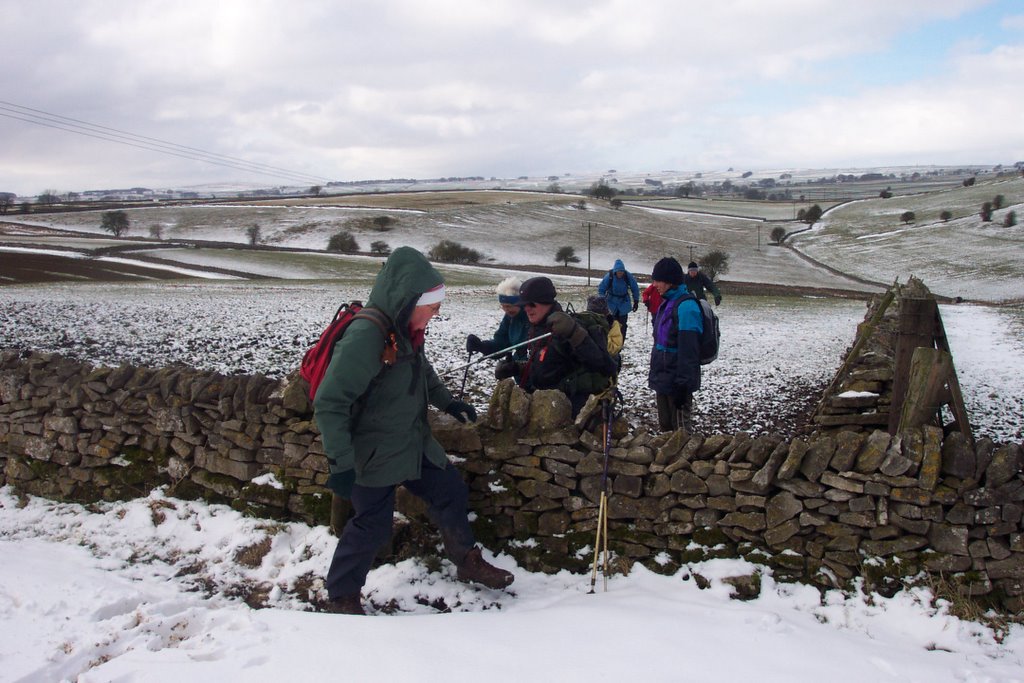
There was a cold wind blowing and the open nature of the countryside, especially on the first half of the walk meant that it was best we kept on the move, though we did shelter underneath a wall for our coffee stop just before 11am.
Deep Dale was muddy and as we tramped up it we got nearer to the snowline. A hare ran across the hillside above us but other than this and some blackbirds there was little wildlife about in the dale itself.
At the top of the dale we reached Wheal Lane, an unsurfaced track, where we turned left. Coffee was taken in the shelter of the wall. Away to our right five Fieldfares flew into a tree as a flock of rooks fed on a field 50 or 60 yards ahead of us. After 15 minutes we had to stick our heads up into the cold air and walk across the fields, into the wind, to Sheldon. We kept moving as fast as we could and eventually enjoyed some respite in the bus shelter at the top of the village.
It was nice walking down through the village, past The Cock and Pullet [it was open as we passed though the open fire viewed through the windows looked inviting].
We turned left on a path at the bottom of the village leading into Little Shacklow Wood. Don and I were saying that it's an uninviting wood though it was a favourite with someone who later ended his life there [and to whom flowers are left by the entrance to a cave in the wood].
The path leading down from the wood to the River Wye was slippery and muddy and some of them walked through the dead undergrowth at the side of it.
We turned left beside the river, with me at that point leading from the back. Then we headed back to White Lodge meeting a few more walkers now, two groups of them following a guidebook and looking underdressed without rucksacks or provisions presumably.
Don left us to walk back along the road but the remaining 12 and Jess followed the path through Great Shacklow Wood to get back to the start. It seems that all enjoyed the walk .... and I was looking forward to whupping the Scots in the Six Nations .... ah well, at least Derby County won.
2 comments:
It looks bleak out there.
Reading your account has reinforced my decision to stick to firm ground for the present.
I read in an earlier article that you carry a small recorder. Good idea that. I find it hard always to remember what I've seen and try to do it by taking a lot of photos.
Do you use GPS on your more remote treks or do you rely on a compass?
It wasn't as bleak as I have experienced - it was the cold wind that was the most testing thing about the walk. We were always reasonably near 'civilisation' though.
This walk can be easily followed using the OS White Peak Map - scale 1:25000. All the field boundaries are shown on this map and this makes things reasonably straightforward.
I only take my digital recorder when I'm working on a book though there is something to be said for having it with you at all times - just in case. As regards remembering what I saw, this walk was only five miles long and I played it back in my head so to speak.
I have a GPS but I tend to use that for spot references only - where I find a signpost is missing or an obstructed stile. Most of the time I will use my compass to follow a line if there's nothing on the ground and nothing visible ahead.
I would like to do more with the GPS but I will need time to do this. One use for the GPS is pinpointing particular sites, burial mounds on open moorland for example.
Get back to me if you have any other queries.
Post a Comment